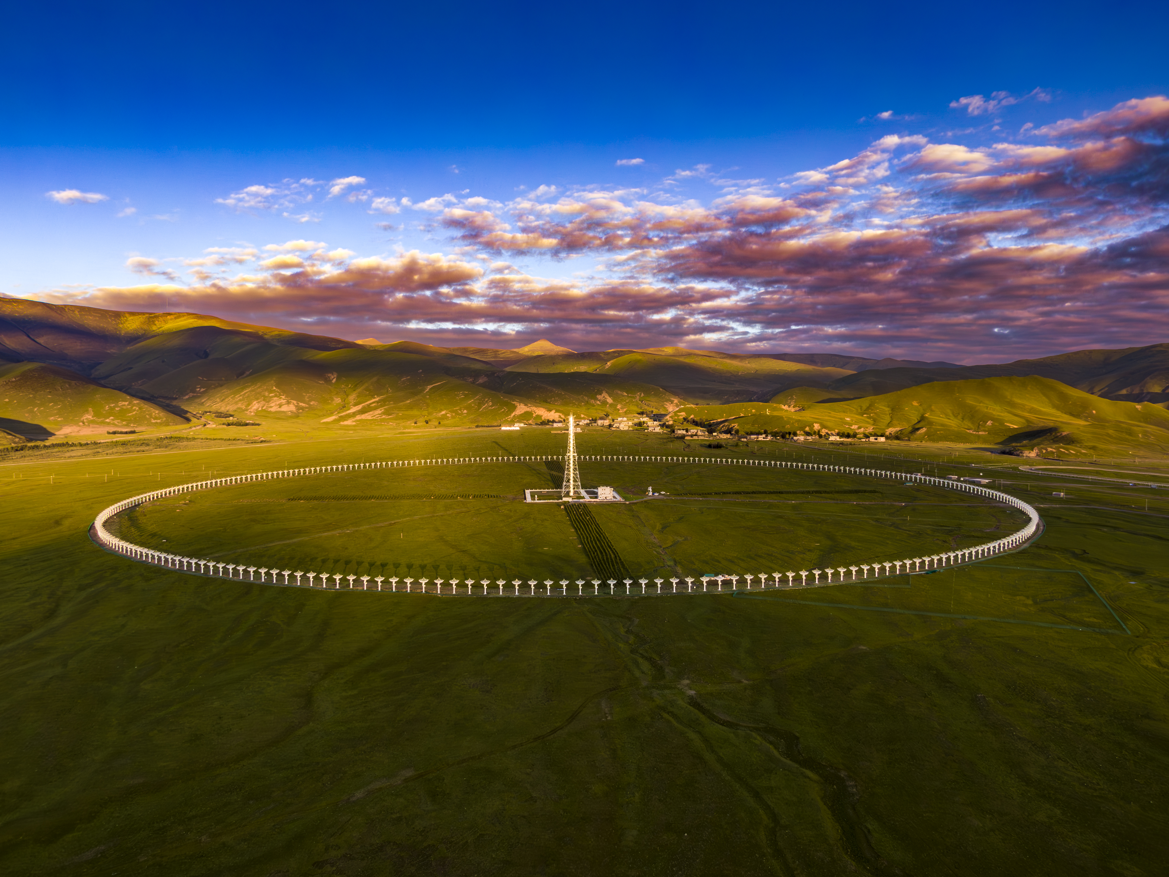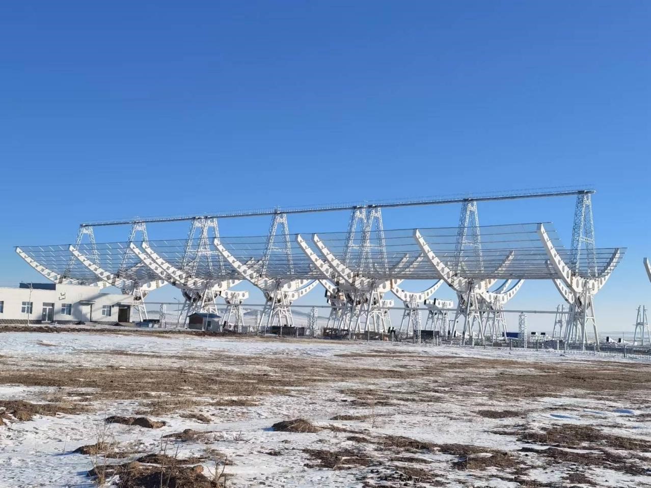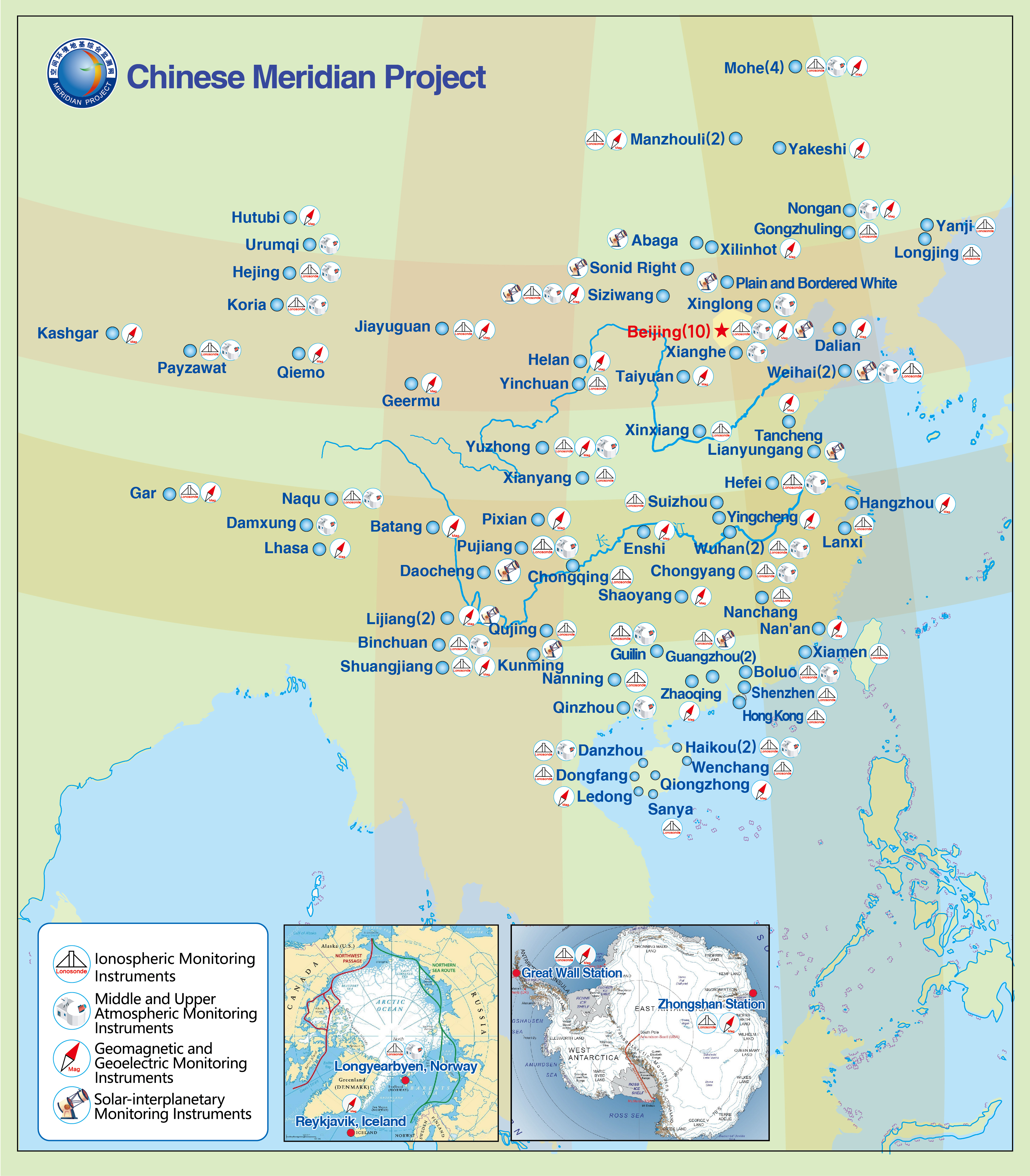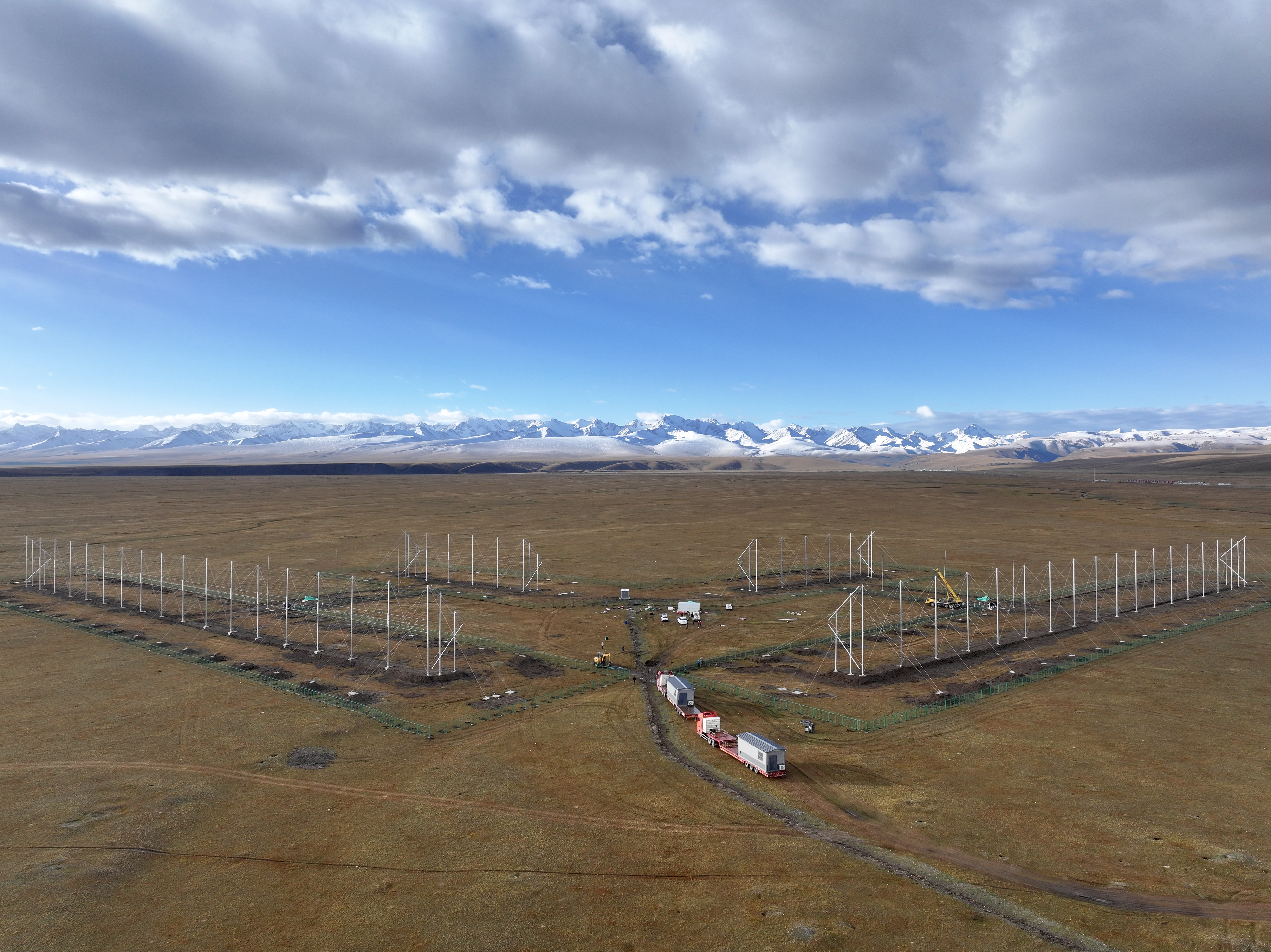
The Chinese Meridian Project (CMP) is a major national science and technology infrastructure project approved by the National Development and Reform Commission. The project deployed 282 sets of monitoring equipment at 31 stations which are located along 100°E, 120°E, 30°N and 40°N, forming a well-shaped layout monitoring network covering China and North and South Poles.
The CMP adopts geomagnetic, radio, optical and other means to monitor the ionosphere, middle and upper atmosphere, and geomagnetism in China (“three networks”). In the polar regions, the northern mid-latitude region, the southern low-latitude region and the Qinghai-Tibet Plateau, the CMP deploys advanced giant monitoring equipment to carry out fine “microscopic” detection of the space environment (“Four Focuses”). A series of advanced solar-interplanetary monitoring equipment has been added to form the ability to monitor the entire chain of solar and terrestrial space (“one chain”). The “one chain, three networks, four focuses” architecture will achieve the world’s first full-layer, multi-element, comprehensive three-dimensional detection of the solar and terrestrial space environment.